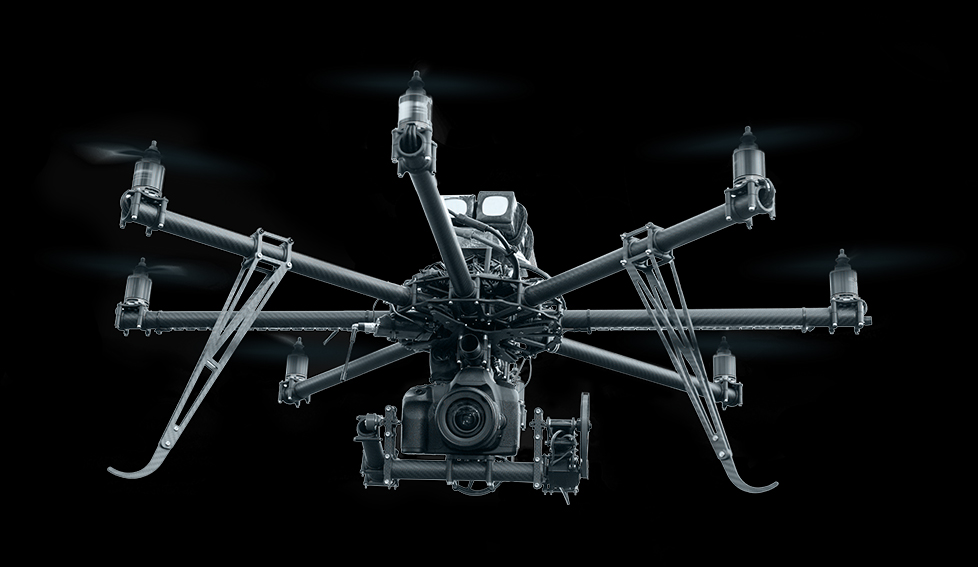
Drone Photography Services produce amazing quality aerial drone photography and aerial filming in Netherlands, Greece and Denmark using the latest GPS enabled multi-rotor UAV drone quadcopters
I have the latest CAA qualification A2 CofC (A2 Certificate of Competency) and GVC which became effective from January 2021.Drone Photography Services are pioneering commercial drone photography flying up to 400ft (120 meters), turning new ideas for aerial imagery into stunning reality.
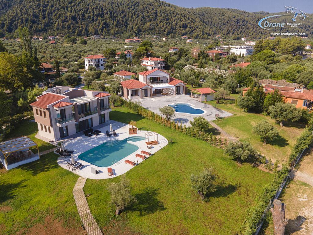
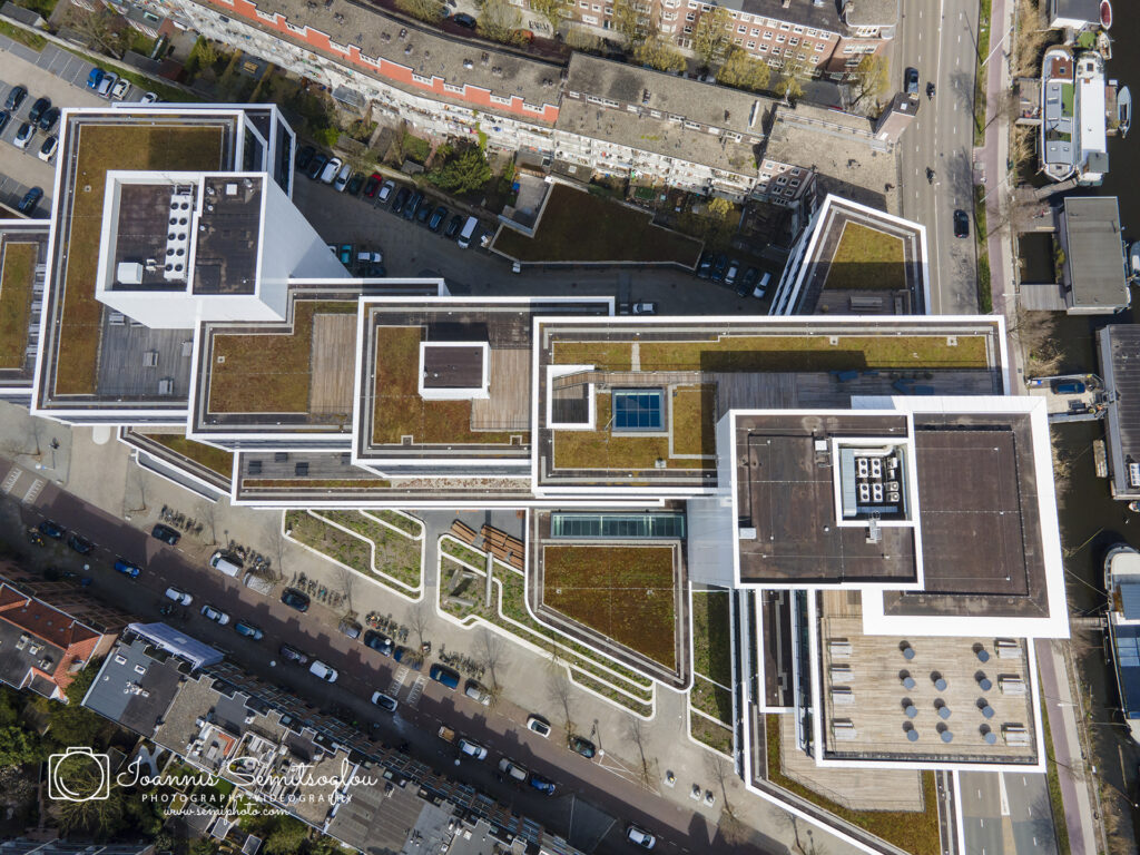
Real Estate Photography and Videography
Every house on the market needs photos! According to the multiple listing service (MLS), homes and properties with drone images are up to 68% more likely to sell than those without them. Aerial photos allow buyers to get a better understanding of what the property looks like, its dimensions, and the surrounding area.All our real estate drone photography packages include up to one hour of flight time on site. The flight will occur as soon as possible, dependent on the weather and your preference for faster turnaround time or clear skies. Imagery hosting is included in all packages at no extra charge.
Construction projects
Diary recording of the progress of a project, construction inspection, road condition inspection, three-dimensional visualization with a photogrammetry. High resolution horizontal photos and 180° and 360° panoramic photos.Civil engineers reinforce the revitalization and amelioration of roads through specific actions and approaches that lead to increased production and maintenance costs, exceeding the stipulated time of road development, unwanted delay of work resources and workforce, and significantly more.
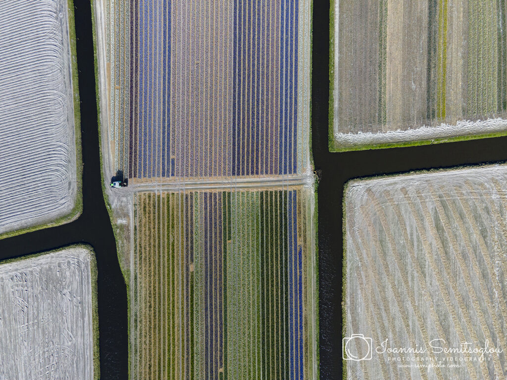
Farmers
Drones provide real-time and accurate data that farmers can act on immediately. They are truly a disruptive technology that is at the beginning of revolutionizing precision agriculture as we know it. Soil analysis is critical for crop yields. Drones can do it faster, cheaper, and more reliably.
Roofing Companies
Because drones are perfect for hard-to-reach areas, an ideal drone photography client is roofing companies! What better way to capture their work than from above? Roofers need advertising photos and videos to show their potential clients examples of their work, and these are very difficult to capture from the ground. Furthermore, roofers incur liability when sending contractors to work at high heights and often prefer avoiding the expense when possible. Aerial photos and videos are perfect for capturing their handiwork, and can be used in marketing materials or on their websites. They can also be used to review their work at the end of a project to inspect a roof without the need to climb up there again.
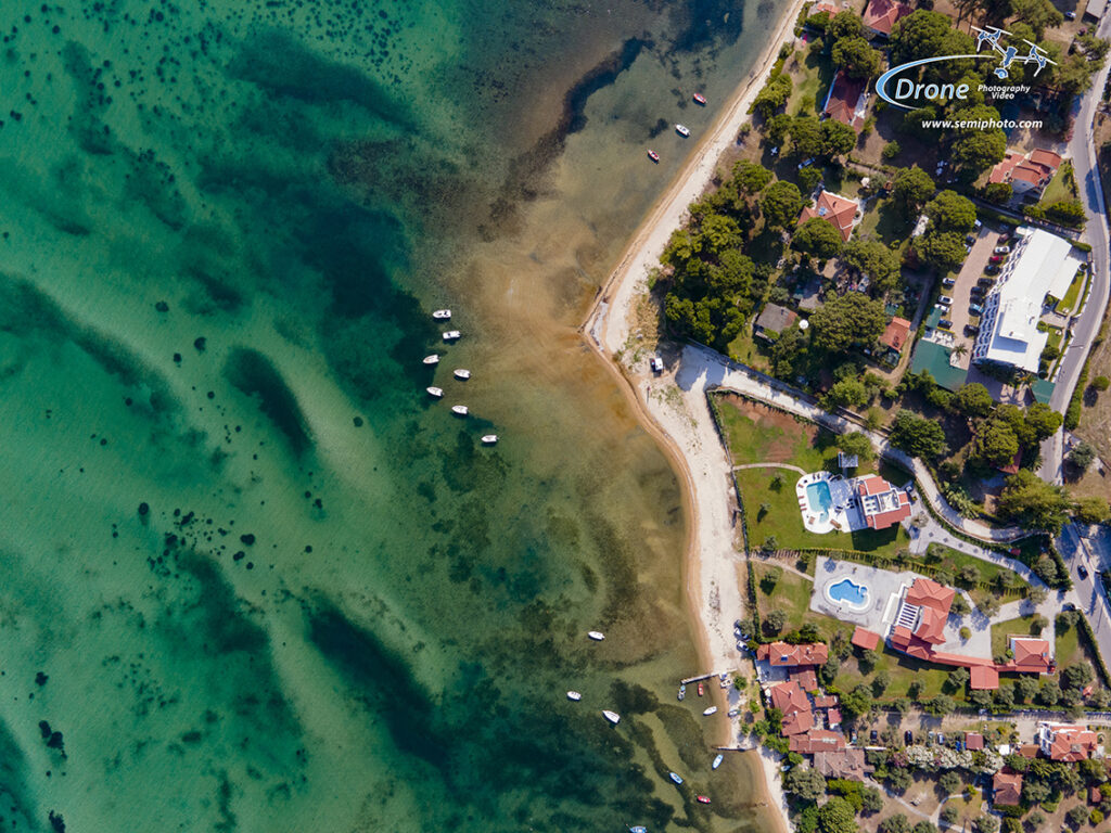
Tourism Boards
The goal of tourism boards is to entice people to visit their location, so they are always in need of quality imagery to use in brochures, flyers, email campaigns and more.Aerial photography could be a great addition to their visual library, as these images are ideal for capturing landscapes and locations in an intriguing way to attract visitors. And this doesn’t have to be far away – even local tourism boards could use beautiful imagery!
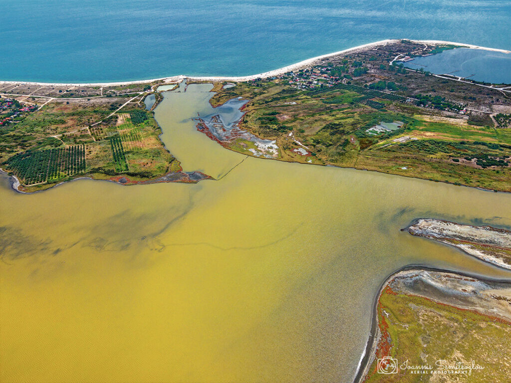
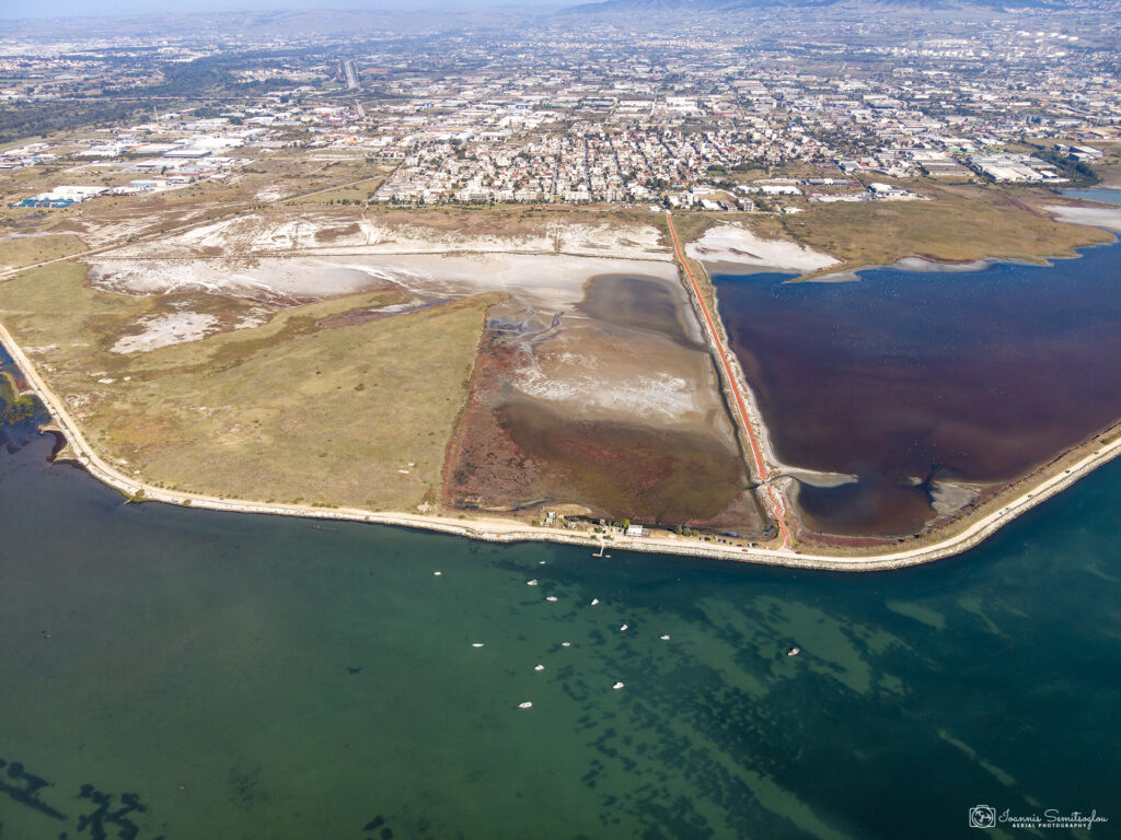
Environmental surveys
Drones are effectively employed to monitor environmental catastrophes in unsafe locations, such as during floods or after storms. Drones may be used in cameras, thermometers, humidity and pressure sensors, wind gauges, and other sensors, allowing them to collect vital environmental data.
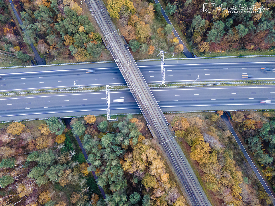
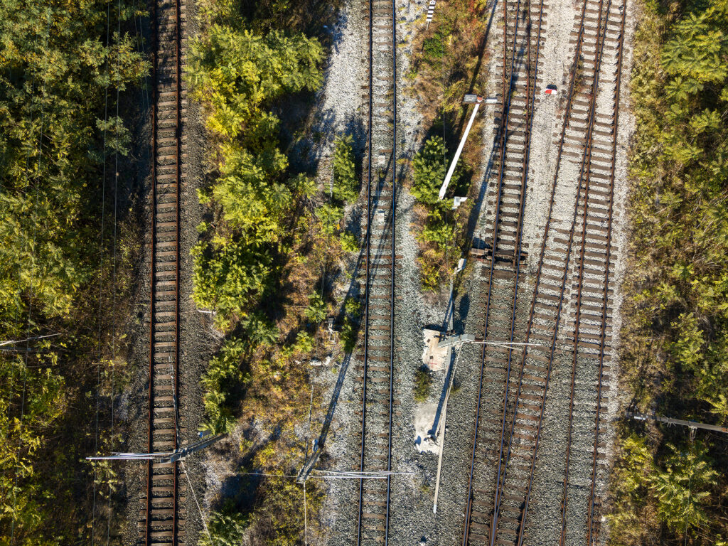
Railroad inpections
Railway inspection can be time-consuming, costly, unreliable and cause disruption to the train schedule. That is why drones are quickly becoming the popular choice to carry out railway infrastructure inspection and surveys. Engineers with Drones can carry out fast and reliable inspections of railway stations and platforms, railway lines, bridges, and overhead power lines covering an extensive area. Without scaffolding or rope access, there are no disruptions to the train lines. Some more added benefits are the lower risk to human life, more cost-efficiency and greater speed.
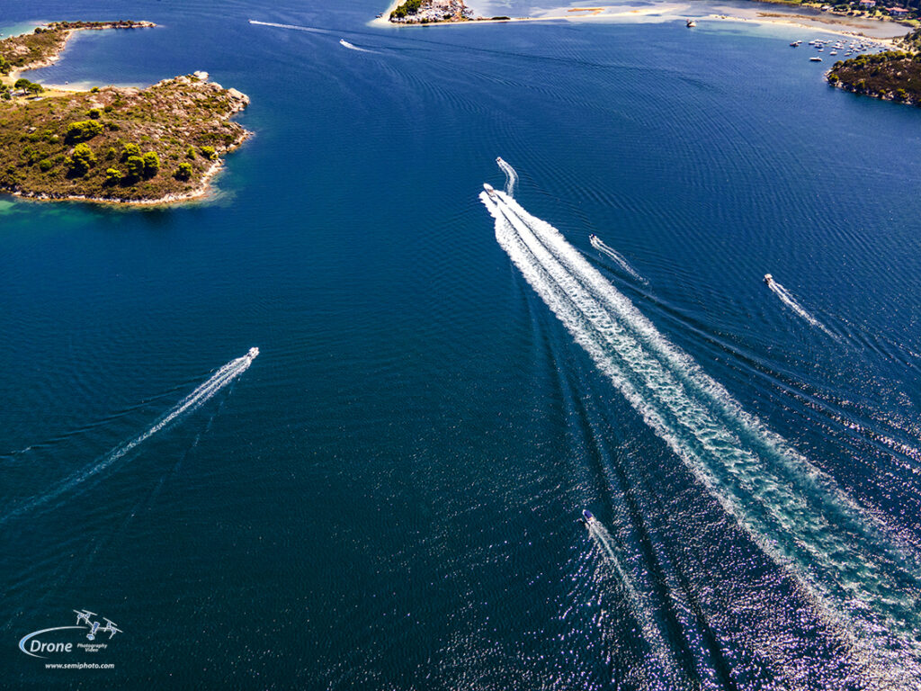
Sports and watersports
The Drone Intelligence Agency’s unmanned aerial vehicle technology with unrestrained coverage will light up your latest athletic or water sport highlight reels. The use of drones in sports events is becoming a very important part of the industry, allowing fans a better viewing experience.As sports teams embrace Unmanned Aerial Vehicles (UAV) to capture footage of their training, practice, or competitive matches, our sports services will help you develop a new game plan that will cement the importance of teamwork and eventually lead to championships.
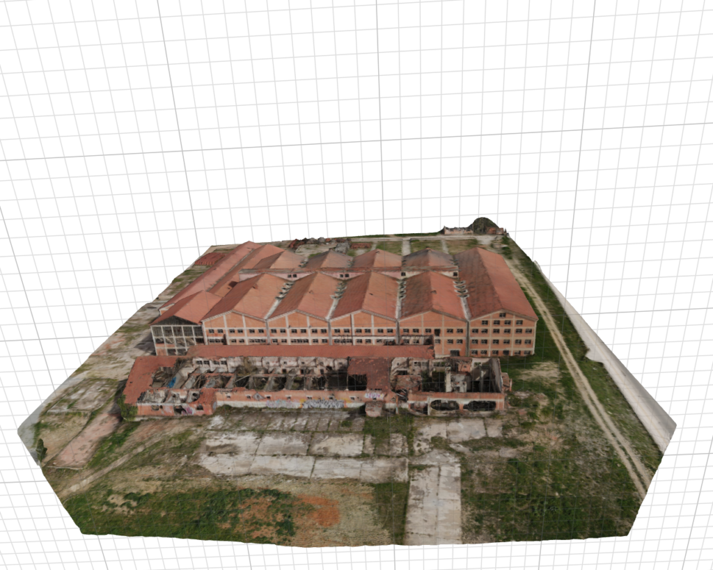
Photogrammetry
Photogrammetry is a sophisticated process by which information is extracted from photographs to create accurate three-dimensional maps and models. Using ultra-high-resolution aerial photographs, this practice combines UAV-mounted overhead sensors with powerful GIS mapping systems to create dynamic, measurable documents for a number of real-world situations and uses.
Scale based aerial photography
(i) Large Scale Photographs: When the scale of an aerial photograph is 1 : 15,000 and larger, the photography is classified as large-scalephotograph. (ii) Medium Scale Photographs: The aerial photographs with a scale rangingbetween 1 : 15,000 and 1 : 30,000 are usually treated as medium scalephotographs. Practical Work in Geography. (iii) Small Scale Photographs: The photographs with the scale being smaller than1 : 30,000, are referred to as small scale photographs.
Content is protected. Right-click function is disabled.
We use cookies to ensure that we give you the best experience on our website. If you continue to use this site we will assume that you are happy with it.Ok